 No matter where you choose to live on the Big Island, you will be living in one of nine designated lava zones on the island. For example, Lava Zone 1 is the highest-risk zone for potential lava hazards, while Lava Zone 9 poses little or no risk at all.
It stands to reason that obtaining lending or homeowner’s insurance could be challenging if you are seeking to live just downslope from an active lava flow in Puna or Kalapana, for example. The upside of living in a Lava Zone 1, however, is that property is substantially more affordable—way more affordable, in fact— than anywhere in the entire state of Hawaii. Additionally, the scenic beauty of remote locations like the old Royal Gardens subdivision on Kilauea’s East Rift Zone attracts a certain kind of homeowner willing to roll the dice on living in a high-risk Lava Zone 1 location. Conversely, the town of Hawi in North Kohala is located in a Lava Zone 9, where the last eruption was more than 60,000 years ago.
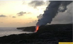
Where are the Lava Zone 1 areas located on the Big Island? In the District of Puna, designated Lava Zone 1 areas include Leilani Estate, Royal Gardens, Kalapana Vacation Lots, and some areas of Kapoho. In the District of Ka‘u, some parts of Ocean View are included in Lava Zone 1. In summary, Lava Zone 1 includes summits and rift zones of Kilauea and Mauna Loa where vents have been repeatedly active in historical time.
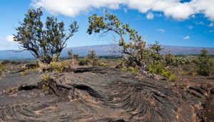 Lava Zone 2 areas are generally adjacent to and downslope of Zone 1. Fifteen to 25-percent of Zone 2’s have been covered by lava since 1800. Relative hazards within Zone 2 decrease gradually as one moves away from Zone 1, according to the Lava-Flow Hazard Zone Map produced by the U.S. Geological Survey. Lava Zone 2 areas include Hawaiian Ocean View Ranchos, Hawaiian Ocean View Estates, Black Sand Beach, Nanawale Estates, Kehena, Kalapana Seaview Estate, parts of Hawaiian Paradise Park, Hawaiian Beaches, parts of Kapoho, Puna Beach Palisades, Kona Paradise, Honomalino, Opiihale and more.
According to U.S. Geological Survey, the hazard zones are based on the locations of probable eruption sites and past eruptions sites. The hazard zones also take into consideration the terrain and topographic features such as steepness of slope that would affect the direction of lava flows.
 Zone 3 is comprised of areas less hazardous than Zone 2, thanks to greater distances from recently active vents. One to five-percent of Zone 3 has been covered since 1800. According to Hawaiian Volcano Observatory, lava-flow hazard zones reflect the long-term hazard, not the short-term: “As Kilauea’s current, and ongoing, middle east rift zone eruption has proven, damage from lava flows will be greater in zone 1 than in any other zone over the long term….” In recent years, they add, it has taken “some time” for lava flows to reach Zone 2 areas, and “the threat was not continuous—it depended on which direction and how fast the lava flows moved downslope.”
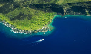
 Kailua-Kona is located in Lava Zone 4, which includes all of Hualalai. Although Hualalai is not extinct, the frequency of eruptions is lower, much lower, than that for Kilauea or Mauna Loa.
One thing is for certain. The goddess Pele is definitely in charge of the aina (land), no matter where you live on Hawaii Island.