 In the aftermath of the recent hurricanes and subsequent flooding that have crippled Texas, Florida, and the islands in the Atlantic Ocean, LUVA Real Estate wanted to give you an update on Hawaii’s flood insurance programs.
The amount Hawaii island residents pay for flood insurance could change when the Flood Insurance Rate Maps (FIRM) for the county take effect this fall.
Changes by the Federal Emergency Management Agency were made to better identify known flood risks. The new maps will be used for flood insurance, land use, development, and regulatory purposes.
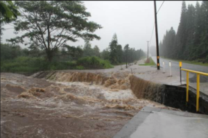
In West Hawaii, the biggest flooding issue we experienced lately was the 2010 Japanese tsunami that flooded downtown Kailua Kona and damaged many homes and businesses from Kealekekua to the Kohala Coast and destroyed the beloved Kona Resort. Localized flooding, due to storms, has caused some issues in South Kona, as well.
If a property is mapped into a high-risk area (a Special Flood Hazard Area labeled with letters starting with “A” or “V”) on the new FIRM and the owner has a mortgage through a federally regulated or insured lender, flood insurance will be required when the FIRM becomes effective. Property owners who obtain flood insurance before the FIRM becomes effective may be able to benefit from the National Flood Insurance Program’s “grandfathering” insurance rating process and pay a lower premium.
The insurance program’s practice of “grandfathering” premiums allows homeowners to continue paying relatively low insurance rates even when the Federal Emergency Management Agency, or FEMA, changes its maps to account for newly discovered risks. The practice is based on the concept that people with homes built to the required codes at the time of purchase shouldn’t be penalized when those codes change.
The new bill, as now written, states that no new grandfathering would be allowed after four years, and premiums on existing grandfathered policies would rise 8 percent yearly until they reach full-risk rates.
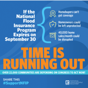
Use of the FIRM is required for the County’s participation in the National Flood Insurance Program (NFIP), which makes the County eligible for federal disaster aid in the event of a federally declared natural disaster.
Congress two years ago decided to phase out the subsidized flood insurance plan, instructing FEMA to draw new flood maps and increase premiums.
With bi-partisan support, Congress then decided to reverse itself in the face of a storm of complaints from homeowners facing much higher rates. (There were stories of homeowners in Oahu facing premium increases of thousands of dollars each year.)
 Local and national Realtors have been vocal about the impact on homeowners with rising flood insurance costs, as selling becomes problematic when premiums are extremely high.
Keeping abreast of this issue as a homeowner or would-be homeowner is prudent. We will write another story later this fall when changes have been made by Congress to let you know how you may be affected.
For further information, please contact LUVA Real Estate directly and we can provide help with current flood maps.